Ghost Towns: The Road to Nabesna


I had incorrectly thought Nabesna was a native village at the end of the road, like Inuvik in the Northern Yukon. Instead it's the best ghost town i have been to in the north. Most people would say Kennicott would hold that title, and it is certainly the biggest. It is also the best preserved. But Nabesna is wild, uncontrolled, and remote. It is also quickly returning to the earth.
Look up Nabesna on the Internet and you will find almost no information. None of my friends up here have gone down the Slana Nabesna road. It's crazy because Nabesna and the surrounding valley have an incredible history.
I had to make a trip directly to a publisher to find a book with any serious amount of information on the subject, and i have borrowed heavily from that book for the history below. The book "Nabesna Gold" by Kirk Stanley, is published by Todd Communcations.

At the headwaters of the Copper River a lone mountain sits in front of Mt. Wrangell - the third highest volcano in North America behind Blackburn and Bona. Like Sanford, it is a shield volcano with a south facing slope that rises 8,000 ft. in one mile.


Nabesna is located in a broad remote valley between the northern Wrangell Mountains and the far eastern Alaska Range. The valley includes the headwaters of the famous Copper River. It is so isolated that nothing at all was known about it's existence (or the people who lived there) until 1885! The last mountains put on the map in the lower 48 states were the Henry Mountains of Utah. Those mountains themselves are very remote but were mapped out in 1872.

In 1867 the United States purchased Alaska, and as such the military was quite concerned about what the heck it had acquired. After the Yukon River had been explored and mapped General Nelson B. Miles (as in Miles City, MT) sent Lt. William Abercrombie on a mission to go up the Copper River and explore the Eastern Alaska Range. The expedition failed. It was 1884.


In 1885 General Miles sent another expedition on the same mission, this time headed by a Westpointe graduate named Lt. Henry T. Allen. After a month of arduous trekking up the Copper River Valley past some of the biggest mountains in North America they made it to the confluence of the Copper River with the Slana River,in sight of the Alaska Range. They were starving. The expedition was going to fail. Then, out of food and exhausted, they were contacted by a previously unknown tribe of Native Americans called the Bazulnetas who escorted the explorers to their village some 12 miles distant. I have heard that even today, nearly 150 years later, there is still a trail in the woods that leads to their long abandoned village.
The Bazulnetas were a strong warrior tribe who controlled the mountains passes and demanded tribute from any other tribes passing through. Additionally, they spoke a language completely different from the Coastal tribes. Their language was more similar to Navajo.
The Bazulnetas fed the explorers Copper River Red Salmon before the worlds finest restaurants knew it existed. They also had one more surprise. They produced the journal of Lt. Serbrinkof of the missing Russian expedition nearly 40 years earlier. According to the Bazulnetas, the Russians were huge jerks, showing up out of nowhere and trying to forcibly take their women and food. Despite having inferior technology, the Bazulnetas fought and killed the Russians. It had been wise of the expedition let by Lt. Allen to treat the natives with the respect they deserved.

One of the views where i camped. I was moderately worried about getting stormed on while i tried to sleep.

Continuing on one morning the road becomes 4 wheel drive only and there are some deep very muddy puddles that bottomed out my high clearance car. I did not want to come to a stop in those mudholes for a picture.

The road becomes so overgrown you will have to sacrifice your paint as you push your way through the alders. This was a painful decision for me because my car is only three years old. After hesitating i decided i didn't buy it for the paint job. I bought it to do this.

After 46 miles there is a fork in the overgrown road and you will begin driving straight up the tailings towards the mine. It had been raining for weeks and the tailings mud radiated a pungent odor drying in the sun.


AHA! My first building came out of the bushes almost without warning.
Strengthened with salmon, the expedition continued onward and the Bazulnetas were left to themselves again for another 12 years. They would have been isolated for decades more if not for the Klondike Gold Rush. Years passed, explorers passed through, and eventually a grizzly bear got really hungry and tried to dig up a ground squirrel.
Yes, a grizzly bear discovered one of the greatest gold deposits in North America. Now that i think about it, i believe it was actually the ground squirrel who literally lived in a hole on the gold. Maybe it was the richest squirrel in history! It didn't matter to the bear. Bears don't care about your social stature. The beast tore into the earth, tossing dirt and rocks all over the place. In no time at all the bear dug out the squirrel and devoured it.
A short time later an interesting fellow by the name of Carl F. Whitham was wandering around on that very ridge. Carl was already a more successful than most miners, but he was still just getting by. For 17 years he had been searching the mountains around Nebesna, trying to find his big score. Over the years he was repeatedly drawn to a particularly interesting mountain, called "White Mountain." This day he was thousands of feet up, higher than he had ever explored on White Mountain. On a narrow ridge near some high cliffs he saw that a grizzly bear had dug into the ground and kicked up a lot of quartz fragments. He picked one up and nearly fell off the mountain when he saw that half of the quartz was solid gold. The motherlode he and others had been searching for, had been teased by for decades by panning, was right under his feet, buried under a little dirt.

A boardwalk along a main set of buildings in town. It was in severely bad shape and not entirely safe for walking.


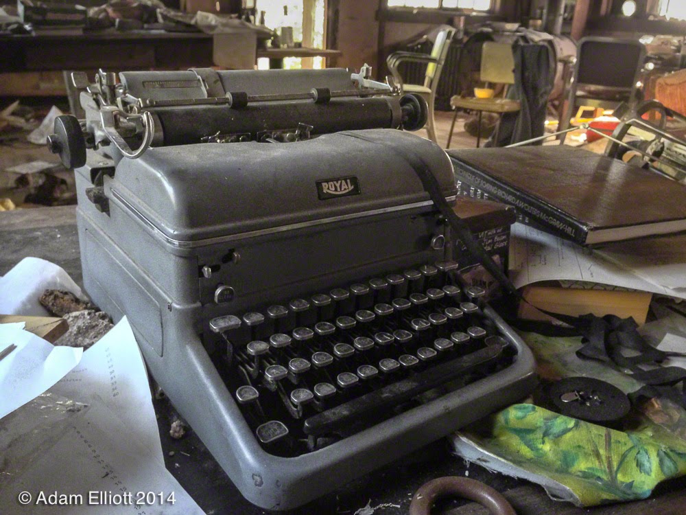
There was so much stuff in here it was unbelievable. I took off my pack, dropped everything and took a while to absorb what i was getting into. This was the kind of ghost town you always imagine but never see in real life, and it wasn't even radioactive!

A table with a roll of developed film sitting in a pile of what looked like gold. I put some on my finger and took it outside in the daylight. It still looked like gold. It was almost definitely pyrite as most of the ore from the mine contained a mixture of pyrite chemically bonded to gold (which means there may indeed be gold in that dust). But what about the film? Someone's personal pictures. The roll appeared to be pictures of snowy winter flatlands with tire ruts and scattered trees. I thought i could take a cool picture holding the film in front of a window close to the camera lens looking through it but i had worked up a sweat climbing around on the hills and was shaking too much for that kind of steady hand and perfect depth of field.


There was a bizarre mixture of very old and pretty much new stuff scattered all around.


There was a lot of evidence of recent occupation/camping, probably by hunters.
I was overwhelmed with photo opportunities but as always, short on time so i took half the pictures with my phone.

Glamour fashion is exactly what remote hard rock miners are concerned most about. There were a number of newspapers, one from 1977 with an editorial about how ironic it was that many Alaskans found it cheaper to fly to Hawaii than to fly to Illiamna (a beautiful area of Alaska with lots of bears and fish). Pretty funny because that's still the way it is today.

In then next building was, oh yes, an abandoned ghost town chemical laboratory.... Fisher brand!


Some old lab equipment. Even the spider webs were abandoned.

Initially the quartz was so rich they could separate the gold with a sledgehammer. But after building another, lower portal into the mountain the ore changed to a much lower quality (but still high quality) gold/pyrite mixtures. For a few years they mined this at lower profits and higher shipping/assay costs until Whitham hired a mining engineer by the name of Philip Holdsworth. Holdsworth experiemented with a process called flotation and when that wasn't efficient enough switched to cyanidation.
Cyanidation involves using a mixture of cyanide and water to dissolve pyrite while leaving silver and gold untouched.The solution is then put into a big tank equipped with rotating blades full of zinc shavings. The zinc combines with the cyanide/pyrite mixture and gold and silver precipitate out as a mud in the bottom of the tank. It can then be melted down.
A video i found in the Alaskan Film Archives of the mine during it's heyday. You'll see the same mountains and scenery in my pictures.

Most of the other buildings were stripped bare except for maybe a bedframe or a small girls pink dresser.

Some buildings are so overgrown it is difficult to get into them.

This one is at an intersection. The blocked road just to the left goes to the mill and one that was behind me goes up to the mine. I had come on a road from the boardwalk buildings.


Up even higher the limestone is capped off by some big lava flows. Weird mountain.

There is a big arch here in the shade. It's the first time i have ever seen an inland rock arch in Alaska. For scale there are some spruce trees in the lower right.

A close up of the arch. Looks like a pile of rubble in the "pit".


The chute for the ore into the mill. The ore was rolled from the tram tower and dumped down the chute into a "jaw crusher". The crusher would break the ore down to 3/4 inch sized rocks.

The entrance to the mill loomed out of the trees like a cave.

The large generators and the jaw breaker have been removed. Other valuable equipment had been sold off decades ago, but some large equipment still remains. There were two upper floors but one of them was very unstable looking. There were also some side rooms but they looked either too dirty or were hanging off the cliff unattached to anything else.


Another movie showing all this stuff working from the cables down to the shaking tables.


Back in the woods i found some more buildings. From what i have read this is the Assay Office, immediately next to the mill. The most important building.

An very angry squirrel had taken command of the Assay Office. The floor was covered in squirrel garbage and that thing did NOT want me in there. Squirrels out in these parts know good livin' when they see it.

I believe the large furnace was used to assay ore. They used electric furnaces to melt the final aggregate into gold bricks after it was assayed. From here it was put onto pack horses and personally escorted by Mr. Whitham a couple of miles to an airfield. Before the airfield was built i believe that Mr. Whitham escorted the gold himself all the way to Cordova.
One last video, this one showing them removing melted gold out of the furnace in the last picture above and pouring into casts. It's just really weird for me to see these old movies with real people and working machines after having seen the old ruins.
One last video, this one showing them removing melted gold out of the furnace in the last picture above and pouring into casts. It's just really weird for me to see these old movies with real people and working machines after having seen the old ruins.

Chemical reactions are far more efficient than shaking a table. However, Phillip Holdsworth had a big career ahead of him, and after he graduated from college he left to go work in a giant mine in the Philippines. The process of cyanidation is a highly skilled with severe restrictions on temperature and acidity/alkalinity. You must respect the chemistry. Holdsworth was the Heisenberg of Nabesna but there was no Jesse Pinkman of Nabesna. When Holdsworth left in 1937 nobody could achieve the same results. Cyanidation was abandoned, replaced by Flotation using pine oil (also an interesting trick). They were able to achieve 10% efficiency with flotation.
Nabesna Mine was doing great and when World War II started Congress passed a law requiring all gold to be bought by the U.S. government. This doubled the amount of money they were getting for their gold. But because of the war Whitham had major problems with finding enough miners. Everyone had joined the war or moved into other industries to support the war. Then, in the fall of 1942 the War Production Board officially ordered closed all gold mines in the United States. The idea was to shift miners to work in copper and iron, for the war effort. After the war Whitham began making major plans to reopen the mine and expand it but within months of making preparations he suddenly died in Seattle. The mine never reopened.

The entrance to the Wrangler mine is less than a 1/2 mile walk up from the road.


The upper mine entrance is super shut. Completely boarded and nailed up with not even a hole to peek through.

The mine seems to be on the boundary between limestone and this gnarly vein of almost pure iron. The rocks that were laying around it were extremely heavy, just like pure iron.


I had a fantastic view of the valley through crystal clear air. The braids of the Nabesna River can be seen in the distance and the place where it cuts through the Mentasta Mountains. The only way to get there is to walk or fly. I still had a 7 hour drive ahead of me but i didn't want to leave so i stayed up here and relaxed for a while.
Sometimes the best thing ever happens, serendipity, and you are provided with a complete surprise on a day with nothing to do. That happened to me on my last day in the Northern Wrangles. I had planned on leaving the park and driving over to the Alaska Range by the Black Rapids Glacier to try and see if i could get up Rainbow Peak the next day. I was going to camp but the weather forecast was not good and projected to get worse. So then i thought i would just go home, but by chance i decided to go to this "ghost town" the lodge workers told me about.
Ghost Towns: The Road to Nabesna
 Reviewed by Unknown
on
11:01
Rating:
Reviewed by Unknown
on
11:01
Rating:
Reviewed by Unknown
on
11:01
Rating:


Hiç yorum yok