Grand Staircase Escalante

After our long day of driving to get to Escalante we wanted a bit of a break so the next day we spent most of our time relaxing. Escalante is pretty high up (5,820 ft/ 1,774 m) so the dependable breeze that day felt good while i sat on the porch reading for much of the afternoon. By 5pm we decided to go for a hike along the Escalante River, which I had never done, always passing by the river on my to or from some other destination.
Scenic Byway 12 passes over the river a little more than 10 miles east of Escalante. From the crossing you can hike 15 miles along the river back to the town or you can walk 70 miles along the river in the other direction, all the way to Lake Powell. We decided to go upstream. The canyons at that point in the river are orange or tan rock but I knew that halfway to town the rock turns white and the river cuts deep alcoves below enormous cliffs. We ran out of time before we got that far. We had walked about 3 miles when I decided we needed to head back before the restaurants closed at 9 pm, or they ran out of food.


The Escalante River is really just a shallow stream rarely more than two feet deep.

A cool arch near the beginning of the hike. There are many worthwhile sites along the way that will lead you off the beaten path and eat up your time.
It was a good relaxing walk for me. Jimmy was apparently having a hard time with hydration, but I wasn't generally aware of that until after the fact. The trail was nice and easy. Some river canyon trails i've been on continuously trudge up and down high sand hills but this trail was mostly flat. It generally cuts across the bends in the canyon, crossing the river here and there. We passed several areas of interest that led us off the path for a while and ate up time, so it's hard to say how long the whole hike would take. I know of a place across from Death Box Hollow where I think you can climb out of the canyon to the road so I think it might be a better idea to divide it into two different hikes.

Some unreachable ruins.


We spent 20 or 30 minutes on a side trip to explore this cool high water side channel that cut along the side of the canyon.

Typical scenery along the way. The river meanders back and forth between each side of the canyon, such as where those trees are, while the trail economically cuts across the oxbows.

Painted walls

One of many refreshing stream crossings
The next day we had to get from Escalante to Page, AZ. I wanted to take a dirt road that bypassed the whole Bryce area, instead driving along the bottom of the plateau crowned by those pinnacles through the west side of the Grand Staircase. There are several roads that do this but heavy rains had caused damage to some of them. After checking current conditions at the BLM office it looked like the best option was a road called Skutumpah Road.
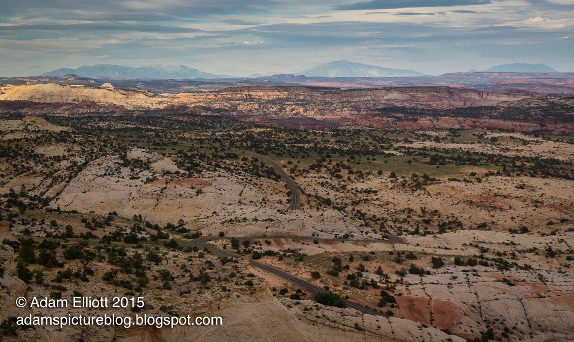
Scenic Byway 12 cuts across Grand Staircase Escalante on it's way towards Boulder. The section that runs between Boulder and Escalante was a New Deal project and was totally unnecessary, simply making it easier in winter to get a little bit of custard from Boulder during the snowier winter months. The original road between the towns is still in use and today is a dirt road called the Hell's Backbone Road.

Escalante Canyon intersection with the road. Down there is where we began our hike. It's close to the more popular Calf Creek Falls trail.
I had never been on Skutumpah Road so I was excited. It turned out to be somewhat disappointing compared to roads like Cottonwood Canyon but it does offer access to some good slot canyons that flow into the Pariah River drainage.
We stopped at one called Bull Valley Gorge. I knew this place from pictures on the internet. It's a deep slot in sparse forest and instead of building a bridge they just threw a bunch of junk into it and laid the road on top of that. When you approach the road from the bottom of the canyon you can look up and see a car or truck wedged in between the narrow walls 60 feet over your head.

This is where we were first able to get into the canyon and ahead there is the first drop.

At the bottom of the first drop.


The second drop involved a commitment to deep mud.
The road seems to cross over the gorge at one of the deepest points, so in order to access the canyon you have to hike a ways up stream along the rim until it gets shallow enough to climb down into it. Once inside, we went only a few feet before a drop off ledge of about 8 -10 feet. The bottom was muddy and after Jimmy jumped into it I asked him to try and climb out. He could not do it because the mud on his shoes was so slippery. I waited until he found another way out before I jumped down. Even after that we probably only got another 50 -100 feet before there was another drop off. This one was down into a muddy pool of water that was probably at least 4 feet deep. We called it off at that point before we got too involved. It had simply been too little time since the last big rain (likely less than 48 hours.).

Jimmy finds an alternate way out.

Looking down into the slot from above.

If you look near the top you can see a chrome bumper and a wheel sticking out of the rubble. That's the back end of the vehicle that's wedged in there. From underneath you can see the front of it.
As I walked back along the rim I studied the bottom and saw at least one other area that involved wading or swimming across a large pool, then somehow awkwardly climbing over a huge boulder in the water to get to another long pool on the other side. Looked like a serious hike, not a quick excursion.

There are so many interesting side options along the Escalante River. It was obvious you could spend many days in the area.
Grand Staircase Escalante
 Reviewed by Unknown
on
10:06
Rating:
Reviewed by Unknown
on
10:06
Rating:
Reviewed by Unknown
on
10:06
Rating:


Hiç yorum yok